
 Here are the details of maps for Shrewsbury (West):

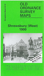
This map of Shrewsbury (West) covers from St Mary's Street westward to include Copthorne Lodge and Crowmeole. Infantry Barracks are to the north of the map along with Millingtons Hospital. Other features include St Chad's Church, Kingsland Bridge and Welsh Bridge, Shire Hall, Kingsland House and Recreation Ground. Street names on the map include St Chad's Terrace, High Street, Frankwell and Claremont Street. On the reverse of the map we include a street directory for the area.
This map links up with Shropshire Sheet 34.07 Shrewsbury (North) to the North-East and 34.11 Shrewsbury (East) to the East