
 Here are the details of maps for Shrewsbury (North):

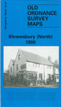
This map of Shrewsbury (North) is double-sided for maximum coverage. The main map shows shows the area around Ditherington, Greenfields, Castlefields and Spring Gardens. Coverage stretches as far east to include Monkmoor. Features on the map show His Majesty's Prison, Gas Works, Isolation Hospital, Newpark Farm,and St Michaels Church. The railway line runs north to south through the left hand side with the station at the bottom of the map. On the reverse, we include a section of map 34.06 which includes Coton Hill and the area around Mountfields. The railway line also features on this map, along with the Vicarage, Shropshire & West Midlands Agricultural Show Ground, Infantry Barracks and Cotonhill Farm.
This map links up with Shropshire Sheet 34.10 Shrewsbury (West) to the South-West and 34.11 Shrewsbury (East) to the South