 Here are the details of maps for Galashiels:

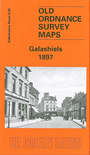
This detailed map captures the Scottish mill town of Galashiels. The sheetlines are not very kind as the town stretches diagonally across the western part of the map, but most of the town centre is covered here. Coverage stretches from Ladhope Cemetery and Low Buckholmside eastward and south to Abbots Mill. The Gala Water runs through the map and features include Gala Mill, Langhaugh Mill, Waverley Mill, St Paul's church, Old Town, Market Place, High Street, railway station, Ladhope House. To the NE the map has part of rural Roxburghshire, including Blaikie's Hill, Wester Hill and Langlee House. Selections from a Galashields trade directory of 1897 are included.