We have published more than 1,800 maps in our series of Old Ordnance Survey Map reprints, some 300 of them in the London area. The maps are highly detailed. They are taken from the OS 1:2,500 (or 25 inch) maps and reduced to about 15 inches to the mile. They show streets with individual houses, tram tracks, railway tracks and even signals, factories, wharves and such details as fountains and water troughs. They will provide hours of fascination for historians and genealogists. The maps are neatly folded and each includes a specially written introduction to the area. Maps can be purchased on our On-line Mapshop where further information about titles is given. For other information and Prices, see Index Page.
Here are the details of maps for Shirley:
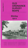
This detailed map covers the area immediately east of Croydon. Part of Addiscombe, including Addiscombe Farm, is in the NW corner, Coombe Park and Coombe Farm in the SW. The rest of the map is quite rural and includes the village of Shirley, including Upper Shirley, St John's church, Pole Wood, Shirley Park, with coverage extending eastward to Swiss Lodge. There are street directory entries on the reverse for Ashburton Road, Clyde Road, Outram Road, Shirley Road and Spring Park Road, together with a railway timetable for the Woodside-Selsdon Road line in 1908.
You might find this Index map useful. The map links up with Surrey Sheets 14.07 Croydon Woodside to the north, 14.10 Central Croydon to the west.
Follow this link for a complete list of our Surrey maps or our London Series.
You can order maps direct from our On-line Mapshop.
For other information and Prices, see Index Page.
Maps in the Godfrey Edition are taken from the 25 inch to the mile map and reduced to about 15 inches to the mile.
For a full list of maps for London, return to the London page.