
 Here are the details of maps for Paisley:

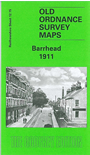
This busy map gives good coverage of Barrhead, from the cotton mill at West Arthurlie eastward to Dovecothall, and northward to Victorian Pottery Works.
Features include Tubal Works, Main Street area with all buildings neatly shown, Dovehill, Arthurlie, churches, tramway, Levern Mill, Carlibar Bridge, Cowan Park, Chappelfield Laundry, Sanitas Works, Arthurlie Biscuit Factory, Grahamston Foundry, Waterside Mills, Darnley Works, Glasgow & Kilmarnock Joint Railway with station, GSWR branch with terminus, CR Paisley & Barrhead line with station, Scotch Pulley Works, Boyleston Quarry, Chappell House, Fereneze Laundry, Corsemill House, etc. On the reverse we include extracts from a trade directory for Barrhead.