Old Ordnance Survey Maps of Renfrewshire

  • These detailed maps normally cover an area of about one and a half miles by one mile. Each map includes an introduction.
  • They are available through our On-line Mapshop

  • Here are the details of maps for Renfrew:

  • Renfrewshire Sheet 8.11 Renfrew 1895 - published 2002; intro by Gilbert Bell. ISBN.978-1-84151-411-6

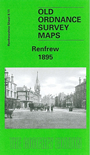
    This detailed map covers most of the small town of Renfrew, with coverage extending southward to Moorpark. Features include White Cart Water, Renfrew Forge & Steel Works, Albert Cabinet Works, GSWR Renfrew Branch with station, Town Hall, town centre with individual buildings neatly shown, Home Farm, Millburn Bridge, Elderslie House, The King's Inch etc. On the reverse we include a trade directory of Renfrew in 1896.

    The map links up with Renfrewshire sheet 8.07 Renfrew N to the north.


  • Follow this link for a complete list of our Renfrewshire maps.
  • You can order maps direct from our On-line Mapshop. For other information and prices, and other areas, go to The Index Page.
  • Maps in the Godfrey Edition are taken from the 25 inch to the mile map and reduced to about 15 inches to the mile. For a full list of maps for Scotland, return to the Scotland page.
    The Godfrey Edition / sales@alangodfreymaps.co.uk / 11 November 2016