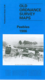
 Here are the details of maps for Peebles:

Our map covers most of the town in detail, with individual buildings neatly shown. Features include town centre, Caledonian Railway with station, engine sheds, North British Railway station, track layout, Tweedside Mills, Victoria Park, Kingsmeadows, Peebles Hydropathic, Frankscroft area, March Street Mills, Damcroft Mills, Damdale Mills, Walker's Haugh, High School, churches, Town Hall, Dean Park, Old Station Bridge, Ninian's Haugh, Auction Mart, Fever Hospital, Poorhouse etc. On the reverse we include extracts from a trade directory.
Peebles was a prosperous town in he 19th century, with railway companies jostling for custom; their lines seem to surround the town. It was also well placed for the mills, with the Tweed running through this map, joined by the Cuddy. The historic town was already enlarged to accomodate housing, industry and a large market, while just outside the town, but on our map, was the Peebles Hydropathic, the so-called "German Bath in Scotland", which was burnt down and rebuilt at about the time of this map.