
 Here is information about Sheet 038:
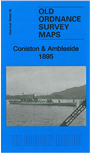
This Inch to the Mile map covers the area from Wast Water eastward to Lake Windermere, and from Grasmere southward to Satterthwaite.
Features include Coniston Water, Furness Railway Coniston Branch, part of Eskdale Railway, Furness Fells, Eskdale Fell, etc. On the reverse we include a detailed map of the centre of the village of Coniston, including railway station, Cat Bank, Dixon Ground, Oak Bank, Great Briary Coppice, St Andrew's church.
It is not possible to list the many hamlets, farmsteads and other topographical features shown on these maps. However, you may find it useful if we list the towns and principal villages or church parishes that are included on this map. Links are given for those for which detailed large-scale maps are also available.
You can order maps direct from our On-line Mapshop. For other information and prices, and other areas, go to The Index Page.