
Old Ordnance Survey Maps of London
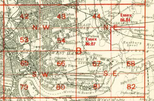
These detailed maps maps normally cover an area of about one and a half miles by one mile. Each map includes an introduction. The London maps link up with those for Middlesex to form a major series for the Greater London area. They
are available through our On-line Mapshop
 Here are the details of maps for North Woolwich:
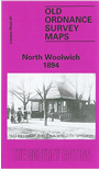
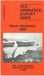
London Sheet 81.1 North Woolwich 1869 - published 1986; intro by Howard Bloch. ISBN.978-0-85054-044-4  London Sheet 81.2 North Woolwich 1894 - published 1988; intro by Howard Bloch. ISBN.978-0-85054-203-5
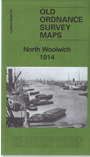
London Sheet 81.3 North Woolwich 1914 - published 2016; intro by Barrie Trinder. ISBN.978-1-84784-982-3
London Sheet 81.2 North Woolwich 1894 - published 1988; intro by Howard Bloch. ISBN.978-0-85054-203-5
London Sheet 81.3 North Woolwich 1914 - published 2016; intro by Barrie Trinder. ISBN.978-1-84784-982-3
We have published three versions of this map, showing how the area developed across the years. The maps each cover the same
area, with North Woolwich well covered but also with a stretch of Woolwich proper, including the High Street and waterfront, at the foot of the map. The area developed greatly over these years,
so the maps are described separately below:
The 1869 map shows North Woolwich at an early stage of development. The railway is shown to North Woolwich station, and near it are the Pavilion Gardens, complete with maze, ball room and dancing platform.
To the west are a few factories and houses, while all around is marshland. South of the river is part of Woolwich with the High Street, piers etc. Our map is labelled "For War Department Purposes Only" and so is remarkable
for showing the War Office lands in full, information normally censored out. This includes a good section of the Royal Arsenal, including Military Store Department and Royal Gun Factory
Department; details such as railway tracks, mortar beds, cranes, even latrines are shown. West of the High Street similar detail is given
for the old dockyard, which launched its last ship in 1869. Here slipways, stores, capstans, docks etc are shown. On the reverse we include an even larger scale map of
Woolwich High Street, from the 10ft to the mile map (here reduced in scale to 5ft to the mile). Wonderful detail.
The 1894 and 1914 maps are very different. Woolwich itself is less interesting here, for the War Dept areas are left blank for security reasons. But North Woolwich is now far more developed. Industry includes Henley's electric telegraph works,
but the major new feature is the Royal Albert Dock, most of which is included, including the Basin and locks to Gallions Reach. On its north side Manor Way and Gallions stations are shown. This area would later see the George V Dock and
today the City Airport. As a bonus, on the reverse of the 1894 map, along with Howard Bloch's introduction, we include the complete OS Index map to the London Series, a valuable map
in its own right to those collecting this series. The 1914 map has extracts from a contemporary street directory.
 Follow this link for a complete list of our London maps .
You can order maps direct from our On-line Mapshop.
For other information and prices, and other areas, go to The Index Page.
Follow this link for a complete list of our London maps .
You can order maps direct from our On-line Mapshop.
For other information and prices, and other areas, go to The Index Page.
Maps in the Godfrey Edition are taken from the 25 inch to the mile map and reduced to about 15 inches to the mile.
For a full list of maps for England, return to the England page.
Alan Godfrey Maps, Prospect Business Park, Leadgate, Consett, Co Durham, DH8 7PW / sales@alangodfreymaps.co.uk / 17 May 2016
 Follow this link for a complete list of our London maps .