
 Here are the details of maps for Northampton (North):

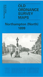
This detailed map covers the northern part of Northampton, with coverage extending from Regent Square and Alcombe Street northward to Balmoral Road and Stanhope Road.
Features include Barracks, Militia Stores, Workhouse, tramways, St Lawrence's church, St Thomas RC Cathedral, Race Course, Kingsthorpe Hollow area, St Andrew's church, St Paul's church, southern part of Queen's Park, St Andrew's Tannery, Dallington Mill, railway approaches, schools, St Andrew's Mill, Halfway House, etc. A selection of street directory entries is included on the reverse, including Barrack Road, Clare Street, Colwyn Road, Grafton Street, Leicester Road, Semilong.
This map links up with Northants Sheet 45.09 Northampton 1899