Old Ordnance Survey Maps of Northamptonshire

  • These detailed maps normally cover an area of about one and a half miles by one mile. Each map includes an introduction.
  • They are available through our On-line Mapshop

  • Here are the details of maps for Wellingborough:

  • Northants Sheet 39.07 Wellingborough 1899 - published 1998; intro by Barrie Trinder. ISBN.978-1-84151-018-7

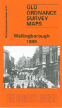
    This detailed map gives good coverage of the town, stretching from Oxford Street eastward to Irtlingborough Ironworks and northward to Burrow's Bush.

    Features include town centre with individual buildings neatly shown, Croyland Abbey, Dulley's Swimming Baths, St Luke's church, Broad Green, Hatton Hall, chapels, All Saints church, schools, Gloucester Place area, Breeze Hill Farm, Midland Railway with station, Locomotive Department, engine shed, Midland Cottages etc. On the reverse we include a list of private residents from an 1898 directory.


  • Follow this link for a complete list of our Northamptonshire maps.
  • You can order maps direct from our On-line Mapshop. For other information and prices, and other areas, go to The Index Page.
  • Maps in the Godfrey Edition are taken from the 25 inch to the mile map and reduced to about 15 inches to the mile. For a full list of maps for England, return to the England page.
    Alan Godfrey Maps, Prospect Business Park, Leadgate, Consett, Co Durham, DH8 7PW / sales@alangodfreymaps.co.uk / 5 January 2018