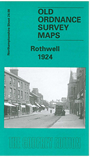
Northants Sheet 24.08 Rothwell 1924 - published 2002; intro by Barrie Trinder. ISBN.978-1-84151-448-2 
This detailed map gives good coverage of Rothwell, with coverage extending eastward to Woodfield Farm, and Glen Hill Farm.
Features include town centre with individual buildings shown, Holy Trinity church, Market Hill area, Ball's Prize Plough Works, Jesus Hospital Almshouses,
Manor House, Ironstone Quarry with mineral tramways, etc. We include an 1898 directory of Rothwell.
Follow this link for a complete list of our Northamptonshire maps.
You can order maps direct from our On-line Mapshop.
For other information and prices, and other areas, go to The Index Page.
Maps in the Godfrey Edition are taken from the 25 inch to the mile map and reduced to about 15 inches to the mile.
For a full list of maps for England, return to the England page.
Alan Godfrey Maps, Prospect Business Park, Leadgate, Consett, Co Durham, DH8 7PW / sales@alangodfreymaps.co.uk / 5 January 2018

 Here are the details of maps for Rothwell: