Old Ordnance Survey Maps of Peterborough


We have published more than 2,000 maps in our series of Old Ordnance Survey Map reprints, including a small group for the Soke of Peterborough. The maps are highly detailed. They are taken from the OS 1:2,500 (or 25 inch) maps and reduced to about 15 inches to the mile. Each covers an area of a mile and a half by a mile. They show streets with individual houses, tram tracks, railway tracks and even signals, factories, wharves and such details as fountains and water troughs. They will provide hours of fascination for historians and genealogists. The maps are neatly folded and each includes a specially written introduction to the area. Maps can be purchased on our On-line Mapshop where further information about titles is given. Or visit The Index Page for a full list to the series and details of Prices.


Here are the details of maps for Peterborough & Dogsthorpe:

  • Northants Sheet 8.07 Peterborough (North) & New England 1924 - published 2006; intro by Barrie Trinder

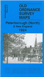
    This detailed map covers the northern part of Peterborough, including New England. A major feature is the railway, running north-south through the map with its many sidings and marshalling yards, all shown in detail. Other railway information includes wagon works, engine shed, engine repair works. Coverage of the maps runs fromWindmill Street and St Martin's Street northward to Scotney Street, and eastward to Garton End Road. The hamlet of Dogsthorpe is in the top right corner. Tramways are shown and other features include The Barracks, Millfield, St Paul's church, Dogsthorpe Grange. On the reverse we include commercial directory entries D-K.

    This map links up with Northants Sheet 8.11 Peterborough to the south.


    Follow this link for a complete list of our Northamptonshire Series maps.

    You can order maps direct from our On-line Mapshop. For other information and prices, and other areas, go to The Index Page.


    Maps in the Godfrey Edition are taken from the 25 inch to the mile map and reduced to about 15 inches to the mile. For a full list of maps for the East Midlands area, return to the East Midlands page

    The Godfrey Edition / godfreyedition@btinternet.com / 3 January 2007