We have published more than 2,100 maps in our series of Old Ordnance Survey Map reprints, including a small group in Monmouthshire or Gwent. The maps are highly detailed. They are taken from the OS 1:2,500 (or 25 inch) maps and reduced to about 15 inches to the mile. Each covers an area of a mile and a half by a mile. They show streets with individual houses, tram tracks, railway tracks and even signals, factories, wharves and such details as fountains and water troughs. They will provide hours of fascination for historians and genealogists. The maps are neatly folded and each includes a specially written introduction to the area. Maps can be purchased on our On-line Mapshop where further information about titles is given. Or visit The Index Page for a full list to the series and details of Prices.
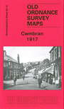
This detailed map covers much of Cwmbran, with coverage stretching from Forge Hammer southward to the Oakfields Steel Wire Works. Features include GWR railway with station, part of Cwm-bran branch, Commercial Street, Vitriol Works, Monmouthshire & Brecon Canal, Patent Nut & Bolt Works, Forge Hammer, iron foundry, Springvale, streets of terraces with individual houses neatly shown, Woodside Brick Works, chapels, St Dials, Greenmeadow etc. On the reverse we include a directory of Cwmbran in 1906.
Follow this link for a complete list of our Monmouthshire Series maps.
You can order maps direct from our On-line Mapshop. For other information and prices, and other areas, go to The Index Page.
Maps in the Godfrey Edition are taken from the 25 inch to the mile map and reduced to about 15 inches to the mile. For a full list of maps for Wales, return to the Wales page.
The Godfrey Edition / godfreyedition@btinternet.com / 29 August 2008