
 Here are the details of maps for Enfield (E):

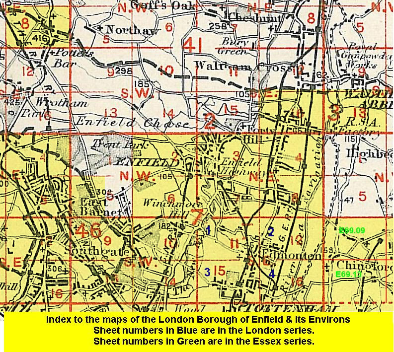
This detailed map covers the eastern part of Enfield known as Enfield Highway. The Hertford Road runs north-south through the map and most development is either side of that, which also has a tramway. The map stretches from Durants Park northward to Bell Lane, and also extends eastward to Brimsdown station and beyond that to the Brimsdown Lead Works. Other industry includes Imperial Lamp Works and numerous nurseries; the Lea Valley was regarded by many as the centre of the world's glasshouse industry. Two of the GER's railways run north-south through the map, and other features include St James's church and cemetery. There are directories for Carterhatch Road, Green Street and Hertford Road on the back.
The map links up with Middlesex Sheets 2.16 Enfield Wash to the north, 7.03 Enfield North to the west, 7.08 Ponders End to the south.
 Follow this link for a list of our maps for the London Borough of Enfield, or here for a complete list of our London maps .