Old Ordnance Survey Maps of Merionethshire
These detailed maps normally cover an area of about one and a half miles by one mile. Each map includes an introduction.
They are available through our On-line Mapshop
 Here are the details of maps for Dolgellau:
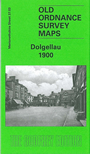
Merionethshire Sheet 37.03 Dolgellau - published 2004; intro by Derrick Pratt. ISBN.978-1-84151-681-3 
This map shows Dolgellau in 1900 with the town itself covering the top right of the map, most of the surrounding areas being covered
heavily by dense forest areas. Areas of interest include the several Woollen Factories, Dolgelly Union Workhouse,
Cambrian Brewery and Eldon Square in the centre of the town. Also featured is Upper Mill (corn) and a Congregational chapel to the very south
of the map. On the reverse there is an area to the north which shows the Cambian Railway and County Hall. The map also includes an historical introduction
by Derrick Pratt.
Follow this link for a complete list of our Merionethshire Series maps.
You can order maps direct from our On-line Mapshop.
For other information and prices, and other areas, go to The Index Page.
Maps in the Godfrey Edition are taken from the 25 inch to the mile map and reduced to about 15 inches to the mile.
For a full list of maps for Wales, return to the Wales page.
The Godfrey Edition / sales@alangodfreymaps.co.uk / 31 March 2018