
 Here are the details of maps for Manningtree:

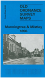
This detailed map covers the two villages of Manningtree and Mistley, with coverage stretching from Lawford Hill and Marsh Row eastward to New Mistley. Features include the village centres of both communities, a stretch of the GER Harwich branch with Mistley station, Brunswick House (lunatic asylum), Mistley Green, St Mary's church Mistley, Baltic Wharf, Furze Hill, Dairy House, Hopping Bridge, numerous mathouses in both villages, Mistley Hall, Barnfield House, Manningtree Channel, Middlebridge Creek, Mistley Park. Stretches of the River Stour and Irelandhole Reach are shown, surrounded by mud. Directories for both villages are given on the back.
Maps in the Godfrey Edition are taken from the 25 inch to the mile map and reduced to about 15 inches to the mile. For a full list of maps for England, return to the England page.
Alan Godfrey Maps, Prospect Business Park, Leadgate, Consett, Co Durham, DH8 7PW / sales@alangodfreymaps.co.uk / 25 November 2017