
 Here are the details of the map for the Monument area:

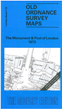
This highly detailed map at a 'Yard to the Mile' scale covers London Bridge and the area around and to the east, on both sides of the Thames. Coverage stretches from Cannon Street station eastward to Great Tower Hill, and from Eastcheap southward to Tooley Street. A small portion of London Bridge station is included and the platform area of Cannon Street station. Major features on the Southwark side include Southwark Cathedral (then St Saviour's church), Borough Market, St Olave's church, many warehouses, wharves, Battlebridge Stairs, Tower Subway. On the City side features include Custom House, Coal Exchange, Lower Thames Street, Billingsgate Market, St Dunstan's church, St Mary at Hill, St Magnus the Martyr church, Allhallows the Great church, Fishmongers Hall, Corn Exchange, Inland Revenue Office, western part of The Tower. On the reverse we include street directory entries for Eastcheap, Lower Thames Street, Pudding Lane, St Mary at Hill and Seething Lane in 1859.
The map links up with sheets 7.66 Bank to the north, 7.75 Bankside to the west, 7.77 The Tower to the east and 7.86 London Bridge Stn to the south.