
Old Ordnance Survey Town Plans of London
These highly detailed maps, at a scale of 1:1760 or a Yard to the Mile, cover parts of central London in exceptional detail. They
are available through our On-line Mapshop
 Here are the details of the map for the Royal Chelsea Hospital area:
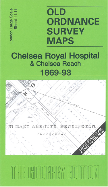
London Large Scale Sheet 11.11 Chelsea Royal Hospital & Chelsea Reach 1869-93 - published 2023. Intro by Alan Godfrey. ISBN.978-1-78721-685-3 
This very detailed map is dominated by Chelsea Royal Hospital, most of which is shown in detail. The main map is the 1869 one. On the reverse we
include a reduced version of the 1893 revision.
Other features include Chelea Reach, Chelsea Waterworks Office, Victoria Railway Bridge, Battersea Park Station etc.
For other Town Plans go to the London Town Plans page. Here is an Index Grid
For a full list of maps for London and Middlesex, return to the London page.
For other information and prices, and other areas, go to The Home Page.
Maps are available through our On-line Mapshop
Alan Godfrey Maps, Prospect Business Park, Leadgate, Consett, DH8 7PW. Tel 01207 583388
The Godfrey Edition / sales@alangodfreymaps.co.uk / 23 January 2024
 Here are the details of the map for the Royal Chelsea Hospital area: