
 Here are the details of the map for the north Chelsea

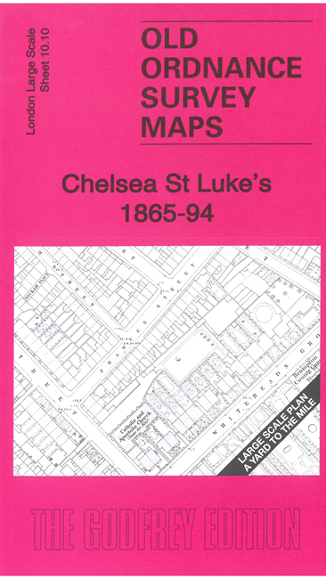
This very detailed map covers the area of Chelsea north of the Kings Road and around St Luke's Church. It is double-sided, with the 1865 map on one side and a reduced version of the 1894 map on the area. We also include an introduction to the history of the area.
Features (from 1865 map) include St Luke's Church, Brompton Hospital, St Paul's Church, Cancer Hospital, St Luke's Workhouse, Catholic & Apostolic Church, Whitelands, Convent, Whitelands Training School, Kings Road, Blacklands House (asylum), etc
The map links up with sheet 6.100 Brompton to the north and 10.20 Chelsea Old Village to the south.