Old Ordnance Survey Maps of Fulham


We have published more than 2,000 maps in our series of Old Ordnance Survey Map reprints, some 300 of them in the London area. The maps are highly detailed. They are taken from the OS 1:2,500 (or 25 inch) maps and reduced to about 15 inches to the mile. They show streets with individual houses, tram tracks, railway tracks and even signals, factories, wharves and such details as fountains and water troughs. They will provide hours of fascination for historians and genealogists. The maps are neatly folded and each includes a specially written introduction to the area. Maps can be purchased on our On-line Mapshop where further information about titles is given. For other information and Prices, see Index Page.


Here are the details of maps for Putney & Fulham:

  • London Sheet 99.1 Putney Bridge & Fulham 1865 - published 2004; introduction by Dorian Gerhold
  • London Sheet 99.2 Putney Bridge 1894 - published 1989; intro by Pamela Taylor
  • London Sheet 99.3 Putney Bridge & Fulham 1865 - published 2002; introduction by Pamela Taylor

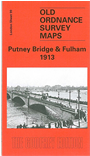
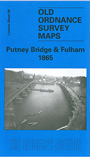
    We have published three versions of this map, showing how the area developed across the years. The maps each cover the same area, stretching from Erpingham Road eastward to Chiddingstone Street, and from Reporton Road southward to Hotham Road. Much of Fulham is coverered, including (1913 version) Fulham Palace, Craven Cottage football ground, The Warren, St James Home penitentiary, Hurlingham Club Grounds, Hurlingham House, Parsons Green, St Dionis church, Putney Bridge and Parsons Green stations, All Saints church, St Etheldreda's church, Fulham Theatre. Features on the Putney side include St Mary's church, Leaders Gardens, All Saints church, Putney Hospital, Polo Grounds, Putney Pier. The two earlier maps are obviously less built up but the 1865 map is especially attractive showing many gardens. Various street directory extracts are included on the maps.
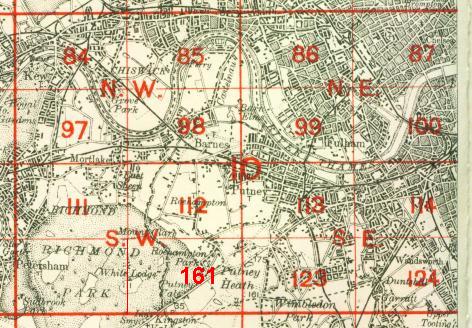
    An index map showing the areas covered by this and adjacent maps is available here. The map links up with London Sheets 99 Putney Bridge to the north, 112 Roehampton to the west, 114 Wandsworth to the east, 123 Southfields to the south.


    Follow this link for a complete list of our London maps .

    You can order maps direct from our On-line Mapshop. For other information and Prices, see Index Page.


    Maps in the Godfrey Edition are taken from the 25 inch to the mile map and reduced to about 15 inches to the mile. For a full list of maps for London, return to the London page

    The Godfrey Edition / godfreyedition@btinternet.com / 20 April 2007