Old Ordnance Survey Maps of Queen's Park


We have published more than 2,000 maps in our series of Old Ordnance Survey Map reprints; this includes more than a hundred in Scotland, with a growing range of maps around Glasgow. The maps are highly detailed. They are taken from the OS 1:2,500 (or 25 inch) maps and reduced to about 15 inches to the mile. Each covers an area of a mile and a half by a mile. They show streets with individual houses, tram tracks, railway tracks and even signals, factories, wharves and such details as fountains and water troughs. They will provide hours of fascination for historians and genealogists. The maps are neatly folded and each includes a specially written introduction to the area. Maps can be purchased on our On-line Mapshop where further information about titles is given. Or visit The Index Page for a full list to the series and details of Prices.


Here are the details of maps for Glasgow Queen's Park:

  • Lanarkshire Sheet 10.02 Glasgow (Queen's Park) 1910 - published 2001; introduction by Gilbert Bell

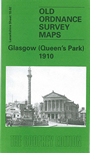
    This detailed map is centred on Queen's Park, with its bandstands, bowling greens and paths, while around it are several of Glasgow's suburban areas: Battlefield, Crosshill, Mount Florida, Langside, Shawlands, Waverley Park, Crossmyloof, Govanhill and the southern part of Strathbungo. Coverage stretches from Nithsdale Street and Fotheringay Road southward to Millbrae Road, and from St Ronan's Drive eastward to Cathcart Road. Features include Titwood Athletic Grounds, Scottish Ice Rink, Langside Wood, several railways including Mount Florida and other stations on the Cathcart Circle, Crossmyloof and Strathbungo stations, Victoria Infirmary, Deaf & Dumb Institution, Camp Hill, Newlandsfield Bleach Works, Coustonholm Works, tramways, Pollokshaws Road, Victoria Cross. John Buchan and Charles Rennie Mackintosh are among those who have lived on this map. We include street directory extracts on the reverse, including Albert Road, Allison Street, Battlefield Avenue, Dixon Avenue, Queen Mary Avenue, Queen's Drive, Regent Park Square.


    You might find this index map useful. The map links up with Sheet 6.14 Pollokshields to the north, 10.01 Pollok Park to the west, 10.03 Rutherglen West to the east, and 10.06 Cathcart to the south.


    Follow this link for a complete list of our Lanarkshire maps.

    You can order maps direct from our On-line Mapshop. For other information and prices, and other areas, go to The Index Page.


    Maps in the Godfrey Edition are taken from the 25 inch to the mile map and reduced to about 15 inches to the mile. For a full list of maps for Scotland, return to the Scotland page.

    The Godfrey Edition / godfreyedition@btinternet.com / 31 December2006