Old Ordnance Survey Maps of West Lothian
These are the maps we publish for West Lothian or Linlithgowshire. Each map includes an introduction.
They are available through our On-line Mapshop
Linlithgowshire's name was changed to West Lothian in 1921. It became a District in Lothian Region in 1975, and
a unitary council in 1996.
See This Page for a summary of the county's local government history.
These are the maps we publish for Linlithgowshire:
Sheet 01.07 Bo'ness 1896 - published 1985, intro by Patrick Cadell
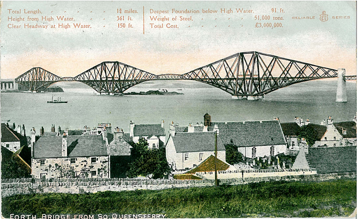
Sheet 02.16 Queensferry & Dalmeny 1895 - published 1995, intro by William F Hendrie
Sheet 05.03 Linlithgow 1895 - published 1992, intro by William F Hendrie
Sheet 09.06 Bathgate 1896 - published 1992, intro by William F Hendrie
 Most maps in the Godfrey Edition are taken from the 25 inch to the mile map and reduced to about 15 inches to the mile.
For a full list of maps for Scotland, return to the Scotland page
You can order maps direct from our On-line Mapshop.
This list shows all our maps for the county. We try to keep a full range in print but inevitably some titles fall out of print from time to time.
These are noted in our On-line Mapshop.
Most maps in the Godfrey Edition are taken from the 25 inch to the mile map and reduced to about 15 inches to the mile.
For a full list of maps for Scotland, return to the Scotland page
You can order maps direct from our On-line Mapshop.
This list shows all our maps for the county. We try to keep a full range in print but inevitably some titles fall out of print from time to time.
These are noted in our On-line Mapshop.
Alan Godfrey Maps, Prospect Business Park, Leadgate, Consett, DH8 7PW. Tel 01207 583388
The Godfrey Edition / sales@alangodfreymaps.co.uk / 6 November 2016