
 Here are the details of maps for Grimsby & Cleethorpes:

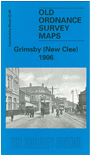
This detailed map covers the eastern part of Grimsby with the western part of Cleethorpes. Coverage stretches from Victor Street eastward to Suggits Lane, and from Harold Street northward to the docks. A major feature on the map is the Fish Docs, which appear in the top left corner. Other points of interest include New Clee Station and Blundell Park Football Ground, which was the original home of Grimsby Town FC from 1889. Sheets 22.03 and 22.04, which show the dock entrances, are included as an insert. On the reverse of the map we include street directory entries for Barcroft Street, Guildford Street, Harrington Street, Hilda Street, Stirling Street, Victor Street and Weelsby Street.
The map links up with Lincolnshire Sheet 22.07 Grimsby North to the west.