Old Ordnance Survey Maps of Ashton-on-Mersey


We have published more than 2,000 maps in our series of Old Ordnance Survey Map reprints, including a large group in Lancashire. The maps are highly detailed. They are taken from the OS 1:2,500 (or 25 inch) maps and reduced to about 15 inches to the mile. Each covers an area of a mile and a half by a mile. They show streets with individual houses, tram tracks, railway tracks and even signals, factories, wharves and such details as fountains and water troughs. They will provide hours of fascination for historians and genealogists. The maps are neatly folded and each includes a specially written introduction to the area. Maps can be purchased on our On-line Mapshop where further information about titles is given. Or visit The Index Page for a full list to the series and details of Prices.


Here are the details of maps for Sale & Ashton-on-Mersey:

  • Lancashire Sheet 110.08 Ashton-on-Mersey 1927 - published 2006; intro by Chris Makepeace

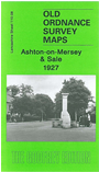
    Although this map is in our Lancashire series, most of the coverage is actually of Cheshire. It covers a busy area of Sale and Ashton-on-Mersey, with Washway Road and Cross Street (part shown as an old Roman Road) as the boundary. Coverage stretches from Harboro Road West and Ashton New Hall eastward to Priory Road and Winstanley Road, and from Northenden Road and Charlton Drive northward to the Ousel Brook. North of the Mersey the only feature is a sewage Farm. Within Sale the many features include Sale Town Hall, Sale and Dane Road stations, School Road, Bridgewater Canal and wharf, Broad Road, Tatton Road etc; within Ashton features include Ashton Lane, picture theatres, Friends Meeting House and burial ground, Grosvenor Road, Ashton Park, St Martin's church, Ashton Hall Farm, Rivershill, Mersey Market Garden etc. We include several extracts from a 1906 street directory on the reverse, incl entries for Ashton Lane, Broad Road, Cross Street, Mersey Road, Tatton Road.


    Follow this link for a complete list of our Trafford area maps.

    You can order maps direct from our On-line Mapshop. For other information and prices, and other areas, go to The Index Page.


    Maps in the Godfrey Edition are taken from the 25 inch to the mile map and reduced to about 15 inches to the mile. For a full list of maps for the North West, return to the North West page.

    The Godfrey Edition / godfreyedition@btinternet.com / 23 June 2007