 Here are the details of maps for Ashton-under-Lyne (N):

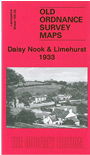
This detailed map covers a busy area on the north side of Ashton-under-Lyne. Coverage stretches from Daisy Nook eastward to Smallshaw, and from Bardsley Bridge southward to Cranbourne Road. Areas shown include Waterloo, Limehurst, Taunton, Well Style, Smallshaw; and features include the Oldham Ashton & Guide Bridge railway, but no stations; stretches of the Manchester & Ashton Canal (Fairbottom and Hollinwood Branches), Medlock Hall, Daisy Nook, Little Moss (in SW corner), Bardsley Vale Mills, Rock Mill, Atlas Mill, Crowhill Farm, Springwood Hall, Limehurst Farm, Newmarket, River Medlock etc. Some extracts from a trade directory are include on the reverse.
The map links up with Lancashire Sheets 97.14 Bardsley to the north, 105.01 Failsworth South to the west, 105.03 Hurst to the east, 105.6Ashton under Lyne to the south. also with Cheshire Sheet 3.09 Ashton & Dukinfield.