
 Here are the details of maps for Whitefield:

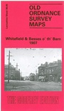
This detailed map covers much of the straggling village of Whitefield, between Bury and Manchester. Coverage extends from Green Lane southward to Hardman's Green, and from Stand Hall eastward to Hodge Lane. The southern part of Whitefield itself is shown, together with the hamlet of Besses o' th' Barn. Bury New Road runs north-south through the map. Features include the railway with Whitefield station, tramways, Half Acre, Kirkhams, Polefield Hall (SE corner of map), Heaps Farm, Thatch Leach, Victoria Mill, Whitefield Brewery, Oak Bank Farm, Hillock, Albert Mill, Moss Lane Works, All Saints church, Whitefield Park, Park Lane, The Dales, Stand Hall, etc. On the reverse we include extracts from 'Whitefield and Stand' by Frank Merriday, written 1899.
The map links up with Lancashire Sheets 96.01 Unsworth to the north, 95.08 Stand to the west, 96.09 Prestwich to the south.