Old Ordnance Survey Maps of Radcliffe


We have published more than 2,100 maps in our series of Old Ordnance Survey Map reprints, including a large group in Lancashire. The maps are highly detailed. They are taken from the OS 1:2,500 (or 25 inch) maps and reduced to about 15 inches to the mile. Each covers an area of a mile and a half by a mile. They show streets with individual houses, tram tracks, railway tracks and even signals, factories, wharves and such details as fountains and water troughs. They will provide hours of fascination for historians and genealogists. The maps are neatly folded and each includes a specially written introduction to the area. Maps can be purchased on our On-line Mapshop where further information about titles is given. Or visit The Index Page for a full list to the series and details of Prices.


Here are the details of maps for Radcliffe:

  • Lancashire Sheet 95.04 Radcliffe 1927 - published 1998; intro by Paul Hindle

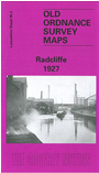
    This detailed map covers much of the Lancashire town of Radcliffe. Coverage stretches from Cams Lane eastward to Bury Street and from Cemetery Road southward to James Street. This is a very busy map and features include St Thomas church, River Irwell, Sun Mills, Globe Iron Works, Irwell Mill, Crystal Mills, Cawdaw Dye Works, Clough Bleach Works, New Road Mills, Irwell Preserve Works, Wellington Mills, Pioneer Mills, Coronation Park, tramways, the Clifton-Accrington railway with Radcliffe Bridge station, the Manchester-Radcliffe line with Radcliffe New station, Radcliffe West Fork with sidings etc, East Lancashire Paper Mill, Wilton Mill, Crow Oaks Works (SE corner of map), Healey Maternity Home, Irwell Bleach and Dye Works, James Street Sidings, Sunny Bank Mill, St Philip's Mission Church, Allen's Green, Peel Park Ground, Spider Mill, Scotson Fold, Canal Mill, Holly Bank Mills, Manchester Bolton & Bury Canal, Smyrna Works, etc. Extracts from a contemporary trade directory are included on the reverse.

    The map links up with Lancashire Sheets 87.16 Radcliffe North to the north, 95.03 Little Lever to the west and 95.08 Stand to the east.


    Follow this link for a complete list of our Rochdale & Bury maps.

    You can order maps direct from our On-line Mapshop. For other information and prices, and other areas, go to The Index Page.


    Maps in the Godfrey Edition are taken from the 25 inch to the mile map and reduced to about 15 inches to the mile. For a full list of maps for the North West, return to the North West page.

    The Godfrey Edition / godfreyedition@btinternet.com / 28 December 2007