We have published more than 2,100 titles in our series of Old Ordnance Survey Map reprints, including a large group in Lancashire and several around Wigan. The maps are highly detailed. They are taken from the OS 1:2,500 (or 25 inch) maps and reduced to about 15 inches to the mile. Each covers an area of a mile and a half by a mile. They show streets with individual houses, tram tracks, railway tracks and even signals, factories, wharves and such details as fountains and water troughs. They will provide hours of fascination for historians and genealogists. The maps are neatly folded and each includes a specially written introduction to the area. Maps can be purchased on our On-line Mapshop where further information about titles is given. Or visit The Index Page for a full list to the series and details of Prices.
Here are the details of maps for Tyldesley:
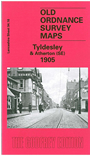
This highly detailed map covers most of the town of Tyldesley, with a portion of Atherton in the NW corner. Features in Tyldesley include railway with station, St George's Bank Colliery, St George's church, Barnfield Cotton Mills, Yew Tee Colliery, Green's Siding, Shakerley Colliery (Wellington Pit and Nelson Pit), Eckersley Farm, Hope Cotton Mill, Field Cotton Mill, Fulwell House, Shuttle Street, Westfield Mill, Chanters Colliery, several mineral lines, tramways, Shakerley Road. At Atherton features include St John's church, Unitarian Chapel. A 1918 directory of Tyldesley is included on the reverse.
The map links up with sheets 94.15 Atherton SW to the west and 95.13 Cleworth Hall to the east.
Follow this link for a complete list of our Wigan area maps.
You can order maps direct from our On-line Mapshop. For other information and prices, and other areas, go to The Index Page.
Maps in the Godfrey Edition are taken from the 25 inch to the mile map and reduced to about 15 inches to the mile. For a full list of maps for the North West, return to the North West page.
The Godfrey Edition / godfreyedition@btinternet.com / 15 April 2008