Old Ordnance Survey Maps of Castleton


We have published more than 2,100 maps in our series of Old Ordnance Survey Map reprints, including a large group in Lancashire. The maps are highly detailed. They are taken from the OS 1:2,500 (or 25 inch) maps and reduced to about 15 inches to the mile. Each covers an area of a mile and a half by a mile. They show streets with individual houses, tram tracks, railway tracks and even signals, factories, wharves and such details as fountains and water troughs. They will provide hours of fascination for historians and genealogists. The maps are neatly folded and each includes a specially written introduction to the area. Maps can be purchased on our On-line Mapshop where further information about titles is given. Or visit The Index Page for a full list to the series and details of Prices.


Here are the details of maps for Castleton:

  • Lancashire Sheet 88.12 Castleton 1908 - published 2007; intro by Paul Hindle

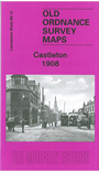
    This detailed map covers Castleton, just south of Rochdale, described by a contemporary directory as a "manufacturing district". It briefly had an Urban District Council but was included in the Borough of Rochdale in 1900. It had a population of 7,363 in 1901. Our map covers the heart of the town, features including the massive Globe Works (for textile machinery), railway station, Arrow Mill, Harp Mill, tramway along the Manchester Road, Globe leather works, Castleton iron works, Bluepits Mill, Linden Mill, Albion Mill, Westbrooke Mill, St Martin's church, railway junctions with a portion of the line to Heywood, Manchet Hall, Marland Mill, Castleton Moor Mill. On the south side of the town are Trub, Fox Hill, Castleton Works (disused), Royle Hill, Royle, Trows Farm. On the reverse we include a directory of Castleton in 1918 plus a railway timetable for the Manchester-Rochdale-Todmorden line in 1914.

    The map links up with Lancashire Sheets 88.11 Heywood to the west, 88.08 Rochdale SW to the north.


    Follow this link for a complete list of our Rochdale & Bury maps.

    You can order maps direct from our On-line Mapshop. For other information and prices, and other areas, go to The Index Page.


    Maps in the Godfrey Edition are taken from the 25 inch to the mile map and reduced to about 15 inches to the mile. For a full list of maps for the North West, return to the North West page.

    The Godfrey Edition / godfreyedition@btinternet.com / 17 December 2007