
 Here are the details of maps for Heywood:

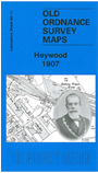
This detailed map covers the mill town of Heywood, just west of Rochdale. About 35 cotton mills are shown on the map, including Yew Mill, Plum Mill, Roeacre Mill and others. Coverage stretches from Lord Street and Rose Hill Mill eastward to Lane End and Harefield Hall. The Bolton & Bury line runs through the map, including Heywood and Broadfield stations, and the railway wagon works. Other features include tramways, Hopwood, Heywood Branch Canal, Captain Fold, All Souls church, St Luke's church, Cartridge Ropery, Bottom o' th' Brow, Broadfield, Sun Iron Works, Phoenix Brewery.We include extracts from a 1918 directory on the reverse.
The map links up with Lancashire Sheets 88.07 Heywood North to the north, 88.10 Heap Bridge to the west and 88.12 Castleton to the east.