Old Ordnance Survey Maps of Sudden


We have published more than 2,100 maps in our series of Old Ordnance Survey Map reprints, including a large group in Lancashire. The maps are highly detailed. They are taken from the OS 1:2,500 (or 25 inch) maps and reduced to about 15 inches to the mile. Each covers an area of a mile and a half by a mile. They show streets with individual houses, tram tracks, railway tracks and even signals, factories, wharves and such details as fountains and water troughs. They will provide hours of fascination for historians and genealogists. The maps are neatly folded and each includes a specially written introduction to the area. Maps can be purchased on our On-line Mapshop where further information about titles is given. Or visit The Index Page for a full list to the series and details of Prices.


Here are the details of maps for Rochdale & Sudden:

  • Lancashire Sheet 88.08 Rochdale (SW) & Sudden 1908 - published 2007; intro by Paul Hindle

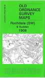
    This detailed map covers the SW area of Rochdale, including the hamlets of Sudden and Marland. Coverage stretches from Freehold Street westward to Heywood Cemetery, and from Sporth Mill southward to Crest Mill. Features include Union Ring Mill, Valley Ring Mill, Castleton Grange, Castleton Gates, Gorrels Farm, a short stretch of the Rochdale Canal, Castleton Lower Mill, Castleton House, Marland Grange, Sudden, River Roch, Marland Hospital, Chamber House, Broadhalgh Mill. On the reverse we include a large extract of Six inch to the Mile sheet 88NE, giving coverage of a wider area, incl Bamford, Broadhalgh, Bagslate Moor, Cutgate, Crimble and western Rochdale.

    The map links up with Lancashire Sheets 88.04 Rochdale West to the north, 88.07 Heywood North to the west, 89.05 Rochdale South to the east and 88.12 Castleton to the south.


    Follow this link for a complete list of our Rochdale & Bury maps.

    You can order maps direct from our On-line Mapshop. For other information and prices, and other areas, go to The Index Page.


    Maps in the Godfrey Edition are taken from the 25 inch to the mile map and reduced to about 15 inches to the mile. For a full list of maps for the North West, return to the North West page.

    The Godfrey Edition / godfreyedition@btinternet.com / 18 December 2007