We have published more than 2,100 maps in our series of Old Ordnance Survey Map reprints, including a large group in Lancashire. The maps are highly detailed. They are taken from the OS 1:2,500 (or 25 inch) maps and reduced to about 15 inches to the mile. Each covers an area of a mile and a half by a mile. They show streets with individual houses, tram tracks, railway tracks and even signals, factories, wharves and such details as fountains and water troughs. They will provide hours of fascination for historians and genealogists. The maps are neatly folded and each includes a specially written introduction to the area. Maps can be purchased on our On-line Mapshop where further information about titles is given. Or visit The Index Page for a full list to the series and details of Prices.
Here are the details of maps for Rochdale (West):
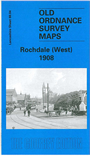
This detailed map covers the western part of Rochdale, with coverage extending from Manchester Road and the Art Gallery westward to Broadhalgh, and from Falinge Fold southward to Sparth Bottoms Road. The many features include cricket ground, Falinge Park, St Edmund's church, Bankside Mill, Sunny Bank Mills, gas works, Mitchell Hey, Mitchell Hey Mills, Standard Mill, Brimrod Mill, Oakenrod Hall, cemetery, tramways and depot, Lenny Barn, Mellor Street Mill, Spotland Bridge, St Clement's church, football ground, Passmonds, Cutgate, Broadhalgh. On the reverse we include street directory entries for Bury Road, Edenfield Road, Spotland Road.
The map links up with Lancashire Sheets 89.01 Rochdale to the east and 88.08 Rochdale SW to the south.
Follow this link for a complete list of our Rochdale & Bury maps.
You can order maps direct from our On-line Mapshop. For other information and prices, and other areas, go to The Index Page.
Maps in the Godfrey Edition are taken from the 25 inch to the mile map and reduced to about 15 inches to the mile. For a full list of maps for the North West, return to the North West page.
The Godfrey Edition / godfreyedition@btinternet.com / 17 December 2007