We have published more than 2,100 maps in our series of Old Ordnance Survey Map reprints, including a large group in Lancashire. The maps are highly detailed. They are taken from the OS 1:2,500 (or 25 inch) maps and reduced to about 15 inches to the mile. Each covers an area of a mile and a half by a mile. They show streets with individual houses, tram tracks, railway tracks and even signals, factories, wharves and such details as fountains and water troughs. They will provide hours of fascination for historians and genealogists. The maps are neatly folded and each includes a specially written introduction to the area.
Maps can be purchased on our On-line Mapshop where further information about titles is given. Or visit The Index Page for a full list to the series and details of Prices.
Here are the details of maps for Horwich (North):
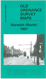
This detailed map covers the northern part of Horwich, with coverage extending north-eastward to Wilderwood. Features include station, Gorton Fold, Grundy Hill, Holy Trinity church, Foxholes Mill, Lee Lane, Winter Hey Lane, Albert Mill, bleach works, tramways and depot, Lee Mill, Lever Park, Knowle House, site of Anderton Old Hall, Wilderswood Mill, Marklands Reservoir, Old Lord's Quarries, Old Lord's Height. On the reverse we include edited extracts from a 1907 directory.
The map links up with Lancashire Sheets 86.10 Horwich (South) to the south.
Follow this link for a complete list of our Bolton maps.
You can order maps direct from our On-line Mapshop. For other information and prices, and other areas, go to The Index Page.
Maps in the Godfrey Edition are taken from the 25 inch to the mile map and reduced to about 15 inches to the mile. For a full list of maps for the North West, return to the North West page.
The Godfrey Edition / godfreyedition@btinternet.com / 24 December 2007