We have published more than 2,100 maps in our series of Old Ordnance Survey Map reprints, including a large group in Lancashire. The maps are highly detailed. They are taken from the OS 1:2,500 (or 25 inch) maps and reduced to about 15 inches to the mile. Each covers an area of a mile and a half by a mile. They show streets with individual houses, tram tracks, railway tracks and even signals, factories, wharves and such details as fountains and water troughs. They will provide hours of fascination for historians and genealogists. The maps are neatly folded and each includes a specially written introduction to the area. Maps can be purchased on our On-line Mapshop where further information about titles is given. Or visit The Index Page for a full list to the series and details of Prices.
Here are the details of maps for Ramsbottom:
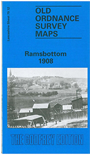
This detailed map covers the Lancashire town of Ramsbottom, a few miles north of Bury. Most of the town is covered, and coverage extends westward to Harcles Hill and Peel Monument, southward to Nuttall Lane. Features include the town centre in detail, with all mills and individual houses neatly delineated, St Paul's church, railway with full track layout, station and sidings, Paper Mill, Square Works, Ramsbottom Mills, Nuttall Hall, Rose Mill, Tanners, Holcombe, Carr, Emanuel church, quarries, Hope Works. On the reverse we include extracts from a contemporary trade directory.
Follow this link for a complete list of our Rochdale & Bury maps.
You can order maps direct from our On-line Mapshop. For other information and prices, and other areas, go to The Index Page.
Maps in the Godfrey Edition are taken from the 25 inch to the mile map and reduced to about 15 inches to the mile. For a full list of maps for the North West, return to the North West page.
The Godfrey Edition / godfreyedition@btinternet.com / 18 December 2007