We have published more than 2,100 maps in our series of Old Ordnance Survey Map reprints, including a large group in Lancashire. The maps are highly detailed. They are taken from the OS 1:2,500 (or 25 inch) maps and reduced to about 15 inches to the mile. Each covers an area of a mile and a half by a mile. They show streets with individual houses, tram tracks, railway tracks and even signals, factories, wharves and such details as fountains and water troughs. They will provide hours of fascination for historians and genealogists. The maps are neatly folded and each includes a specially written introduction to the area. Maps can be purchased on our On-line Mapshop where further information about titles is given. Or visit The Index Page for a full list to the series and details of Prices.
Here are the details of maps for Bacup:
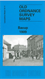
This detailed map covers the Rossendale town of Bacup, with the town centre on the eastern side of the map. Coverage then stretches westward to Pilling Barn Lane, and from Rockliffe Road northward to Broad Clough. Features include Forest Mill, Huttock Top, Stacksteads Colliery with tramways, St John's church, Lane Head, Market Hall, Tong Mill, Bacup Mill, Holmes Mills, Meadows Mill, Old Meadows Colliery with tramway, Maden Recreation Ground etc. We include extracts from a directory on the reverse, in the commercial entry A-C.
The map links up with Lancashire sheet 72.15 Stacksteads to the south.
Follow this link for a complete list of our East Lancashire maps.
You can order maps direct from our On-line Mapshop. For other information and prices, and other areas, go to The Index Page.
Maps in the Godfrey Edition are taken from the 25 inch to the mile map and reduced to about 15 inches to the mile. For a full list of maps for the North West, return to the North West page.
The Godfrey Edition / godfreyedition@btinternet.com / 18 January 2008