Old Ordnance Survey Maps of Preston


We have published more than 2,100 maps in our series of Old Ordnance Survey Map reprints, including a large group in Lancashire. The maps are highly detailed. They are taken from the OS 1:2,500 (or 25 inch) maps and reduced to about 15 inches to the mile. Each covers an area of a mile and a half by a mile. They show streets with individual houses, tram tracks, railway tracks and even signals, factories, wharves and such details as fountains and water troughs. They will provide hours of fascination for historians and genealogists. The maps are neatly folded and each includes a specially written introduction to the area. Maps can be purchased on our On-line Mapshop where further information about titles is given. Or visit The Index Page for a full list to the series and details of Prices.


Here are the details of maps for Preston (West):

  • Lancashire Sheet 61.09 Preston (West) 1909 - published 1994; intro by Nigel Morgan

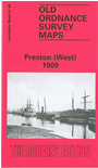
    This detailed map covers the western part of Preston, including the dock area. Coverage stretches from Brook Street westward to Ashton Park, and from Eldon Street southward to the River Ribble. Features include railways with LNWR engine shed, Greenbank Goods station, Maudland Goods station, Maudland Viaduct, lines in docks; English Electric Works, United Electric Car Works, Albert Edward Dock, Spa Mill, Wellfield Road Mill, StWalburge's RC church, Caledonian Mill, Fylde Road Mill, Soho Foundry, Lancaster Canal, tramways, Aqueduct Mill, Progress Mill, Eldon Street Mill, Brookhouse Mill, Shelley Road Mills, Arkwright Mill, Ashton on Ribble area, Ashton Park, Tulketh Hall etc. On the reverse we include extracts from a street directory, incl Fylde Road, Marsh Lane, Maudland Bank, Waterloo Road, Waterloo Terrace, Watery Lane.

    The map links up with Sheet 61.10 Central Preston to the east.


    Follow this link for a complete list of our Fylde area maps.

    You can order maps direct from our On-line Mapshop. For other information and prices, and other areas, go to The Index Page.


    Maps in the Godfrey Edition are taken from the 25 inch to the mile map and reduced to about 15 inches to the mile. For a full list of maps for the North West, return to the North West page.

    The Godfrey Edition / godfreyedition@btinternet.com / 22 February 2008