Old Ordnance Survey Maps of Lancashire

  • These detailed maps normally cover an area of about one and a half miles by one mile. Each map includes an introduction.
  • They are available through our On-line Mapshop

  • Here are the details of maps for Lytham (North):

  • Lancashire Sheet 59.14 Lytham Hall 1908 - published 1998; intro by Martin Ramsbottom. ISBN.978-0-85054-953-9

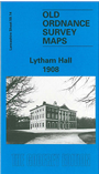
    This detailed map covers the northern part of Lytham, around Lytham Hall. Though largely rural or parkland, several Ansdell streets around Rossall Road and Common Side are included. The map also extends north to Hey Houses. Features include Ansdell & Fairhaven station, Woodlands, Big Wood, Hall Wood, Lytham Hall. Directories of private residents in Ansdell and Lytham in 1918 are included on the reverse.

    The map links up with sheets 59.13 St Annes to the west and 67.02 Lytham to the south.


    Follow this link for a list of our Lancashire maps.
  • You can order maps direct from our On-line Mapshop. For other information and prices, and other areas, go to The Index Page.
  • Maps in the Godfrey Edition are taken from the 25 inch to the mile map and reduced to about 15 inches to the mile. For a full list of maps for the North West, return to the North West page.
    The Godfrey Edition / sales@alangodfreymaps.co.uk / 17 January 2018