
 Here are the details of maps for Colne (South):

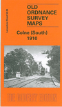
This detailed map covers the southern part of Colne; coverage stretches from Cloth Hall Yard southward to Fox Clough and westward to White Walls. Features include the railway with station, engine and carriage sheds; Albert Road with tramway, Spring Gardens Mill, Knotts Lane Mills, Great Holme Mill, Stanley Mills, Sansbury Brick & Tile Works, Rowling Hollins, Knotts Lane Brick Works, Colne Water, Lenches, Town Hall, Cattle Market, Bunker's Hill, Greenfield, Haggate Gate, Primet Mill and Foundry, Garden Vale Mill, Church Clough, Carry Bridge. On the reverse we include a selection of extracts from a contemporary trade directory.
The map links up with Lancashire Sheet 48.16 Colne North to the north.