We have published more than 2,100 maps in our series of Old Ordnance Survey Map reprints, including a large group in Lancashire. The maps are highly detailed. They are taken from the OS 1:2,500 (or 25 inch) maps and reduced to about 15 inches to the mile. Each covers an area of a mile and a half by a mile. They show streets with individual houses, tram tracks, railway tracks and even signals, factories, wharves and such details as fountains and water troughs. They will provide hours of fascination for historians and genealogists. The maps are neatly folded and each includes a specially written introduction to the area. Maps can be purchased on our On-line Mapshop where further information about titles is given. Or visit The Index Page for a full list to the series and details of Prices.
Here are the details of maps for Blackpool (Central Pier):
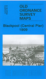
This detailed map covers the area of Blackpool around the Central Pier and "Golden Mile". Features include most of Central station and the railway approaches, including engine depot; Bloomfield Road football ground, gasworks, tram depot, Central Drive, promenade south to Shaw Road, Revoe, Central Pier. On the reverse are street directories for Alexandra Road, Central Drive, Promenade (South) in 1934.
The map links up with Sheets 50.12 Blackpool (North Pier) to the north, 58.04 Blackpool South to the south.
Follow this link for a complete list of our Fylde area maps.
You can order maps direct from our On-line Mapshop. For other information and prices, and other areas, go to The Index Page.
Maps in the Godfrey Edition are taken from the 25 inch to the mile map and reduced to about 15 inches to the mile. For a full list of maps for the North West, return to the North West page.
The Godfrey Edition / godfreyedition@btinternet.com / 4 December 2007