
 Here are the details of maps for Lancaster (South):

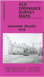
This detailed map covers the southern part of Lancaster. Coverage stretches from Aberdeen Road and the cattle market southward to the Royal Albert Asylum, and from Golgotha Road westward to Aldcliffe Hall. Major features include White Cross Mills, Royal Lancaster Infirmary, Ripley Hospital (Orphanage), Nazareth House, Royal Albert Asylum, Royal Albert Farm, tramways, Queen's Mill, The Greaves, Bowerham, Moorside, Bowerham Barracks, Primrose Hill, LNWR engine shed, Lancaster Canal. Part of Aldcliffe around Aldcliffe Hall (but not church) is in SW corner.
The map links up with Lancashire Sheet 30.11 Lancaster to the north.