We have published more than 2,500 maps in our series of Old Ordnance Survey Map reprints, including a group in Kent. The maps are highly detailed. They are taken from the OS 1:2,500 (or 25 inch) maps and reduced to about 15 inches to the mile. Each covers an area of a mile and a half by a mile. They show streets with individual houses, tram tracks, railway tracks and even signals, factories, wharves and such details as fountains and water troughs. They will provide hours of fascination for historians and genealogists. The maps are neatly folded and each includes a specially written introduction to the area. Maps can be purchased on our On-line Mapshop where further information about titles is given. Or visit The Index Page for a full list to the series and details of Prices.
Here are the details of maps for Sittingbourne:
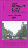
This detailed map covers much of the twin town of Sittingbourne and Milton, with coverage stretching from Chalkwell eastward along Watling Street to East Street.
Features include railway with station, paper mill, Crown Quay, Holy Trinity church, St Michael's church, Tide Mill, Milton Quay, Chalkwell Tannery, Barrow School, Ufton Court (at foot of map), Bayford Court etc. On the reverse we include a list of private residents from a 1905 directory.
Follow this link for a complete list of our Kent Series maps.
You can order maps direct from our On-line Mapshop. For other information and prices, and other areas, go to The Index Page.
Maps in the Godfrey Edition are taken from the 25 inch to the mile map and reduced to about 15 inches to the mile. For a full list of maps for Kent, return to the South East page
The Godfrey Edition / godfreyedition@btinternet.com / 2 May 2012