Old Ordnance Survey Maps of Kent

  • These detailed maps normally cover an area of about one and a half miles by one mile. Each map includes an introduction.
  • They are available through our On-line Mapshop

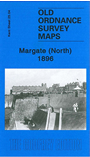
  • Here are the details of maps for Margate (N):

  • Kent Sheet 25.04 Margate (North) 1896 - published 2010; intro by Barrie Trinder. ISBN.978-1-84784-381-4

    This detailed map covers the northern part of Margate, including much of Cliftonville Ward, with coverage stretching from Marine Drive and the Harbour eastward to Fifth Avenue, and from the shore southward to Cecil Square.

    Features include Fort Green, Trnity church, gas works, Harbour, The Pier, Jetty Extension, brewery, college, Chateau Bellevue, Marine Palace, Fort Point, Clifton Baths, St Paul's church, Esplanade, Market Place etc. On the reverse we include a list of private residents, entries A-H.

    The map links up with sheet 25.08 Margate (South) to the south.


  • For other maps in Kent see our Kent page.
  • You can order maps direct from our On-line Mapshop. For other information and prices, go to The Index Page.
  • Maps in the Godfrey Edition are taken from the 25 inch to the mile map and reduced to about 15 inches to the mile. For a full list of maps for England, return to the England page
    The Godfrey Edition / sales@alangodfreymaps.co.uk / 3 December 2016