We have published more than 2,400 maps in our series of Old Ordnance Survey Map reprints, including some in the Isle of Man. The maps are highly detailed. They are taken from the OS 1:2,500 (or 25 inch) maps and reduced to about 15 inches to the mile. Each covers an area of a mile and a half by a mile. They show streets with individual houses, tram tracks, railway tracks and even signals, factories, wharves and such details as fountains and water troughs. They will provide hours of fascination for historians and genealogists. The maps are neatly folded and each includes a specially written introduction to the area. Maps can be purchased on our On-line Mapshop where further information about titles is given. Or visit The Index Page for a full list to the series and details of Prices.
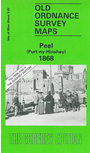
Here are the details of maps for Peel:
This very detailed map is double-sided for maximum coverage.
The main map covers the town and immediate surroundings, with coverage running from Thistle Head eastward to Ballaquane House. Feeatures include the town centre with individual houses neatly shown, St Patrick's Isle, Castle, Peel Hill, harbour, Scotch Quarter, St Peter's church, St German's Cathedral, Creg Malin, Traie Fogog, Ballawattleworth, flour mill, rope works, etc.
On the reverse we extend coverage southward to include Glenfaba Mills, Raggatt, Corrins Hill, Corrins Folly, Ballaterson etc.
This map is dedicated to the memory of the comnposer Bill Hopkins, who lived in Peel for many years, and with whom the beginnings of this series were first discussed.
Follow this link for other maps for Isle of Man maps together with prices and other details.
You can order maps direct from our On-line Mapshop. For other information, and other areas, go to The Index Page.
Maps in the Godfrey Edition are taken from the 25 inch to the mile map and reduced to about 15 inches to the mile. For a full list of maps for Ireland, return to the Ireland page.
The Godfrey Edition / godfreyedition@btinternet.com / 18 Jan 2011