Old Ordnance Survey Maps of Inverness-shire
We have published a small range of detailed maps for Inverness-shire, taken from the OS 1:2,500 maps and reduced to approx 14 inches to the mile. Each covers an area of a mile by a mile and a half, and shows the area in great detail, including individual buildings.
Maps are available through our On-line Mapshop.
Information pages are given for individual titles; simply follow the links below.
These are the detailed maps currently available in our Inverness-shire series:
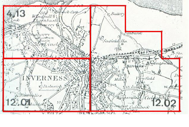
04.13 Inverness (North) 1903 - published 1990; introduction by Peter Reynolds
12.01 Inverness (West) 1903 - published 1989, intro by Peter Reynolds
12.02 Inverness (East) 1903 - published 1989, intro by Peter Reynolds
You might find this Index Map useful.
Most maps in the Godfrey Edition are taken from the 25 inch to the mile map and reduced to about 15 inches to the mile.
They cost just £ 3.00 each. For a full list of Scottish maps, return to the Scotland page
You can order maps direct from our On-line Mapshop.
This list shows all our maps for the area. We try to keep a full range in print but inevitably some titles fall out of print from time to time.
These are noted in our On-line Mapshop.
Alan Godfrey Maps, Prospect Business Park, Leadgate, Consett, DH8 7PW. Tel 01207 583388
The Godfrey Edition / sales@alangodfreymaps.co.uk / 17 Nov 2016