Old Ordnance Survey Maps of Hull

  • For the central area of Hull we have reprinted four of the very early Five-foot plans, here reduced in scale to 1:1760 or a Yard to the Mile. The maps, though covering quite a small area, are extremely detailed, showing such features as capstans and mooring posts, lamp-posts, the layouts of back yards, and even the interior of certain public buildings. They are available through our On-line Mapshop

  • Here are the details of the map for Hull Old Town:

  • Kingston upon Hull: sheet 12 Hull Old Town 1853 - published 1988; intro by A G Credland. ISBN.978-0-85054-272-1

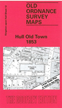
    This wonderfully detailed map covers the much of the Old Town of Hull, the principal streets being Whitefriargate, Lowgate, Market Place, Mytongate, Blanket Row, Blackfriargate, Trinity House Lane. These are shown in great detail and features include Theatre Royal, South End Graving Dock, warehouses, Trinity church, Trinity House, Watson's Hospital, Humber Dock, part of Prince's Dock, Junction Bridge. To the east is the Citadel, incl Block House, barracks, Garrison Moat. On the reverse we extend coverage east by including part of adjacent sheet 13, showing the rest of the Citadel, Victoria Dock, Victoria Dock Basin..

    The map links up with sheets 8 Hull (Queen's Dock) to the north and 11 Hull (Railway Dock) to the west.


  • You can order maps direct from our On-line Mapshop. For other information and prices, and other areas, go to The Index Page.
  • The town plans are taken from the OS five-foot plans and reduced to a scale of a yard to the mile. Follow this link for a complete list of our Hull maps or all the Yorkshire maps.
    Alan Godfrey Maps, Prospect Business Park, Leadgate, Consett, Co Durham, DH8 7PW / sales@alangodfreymaps.co.uk / 20 Sept 2016