 Here are the details of maps for Ross-on-Wye:

We have published a pair of maps for Ross-on-Wye. These link up with each other to provide excellent coverage of the town.
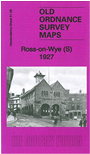
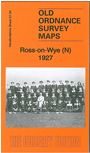
Sheet 51.04 covers the northern part of the town, from Broad Street northward. Features include railway with station, engine shed, Ross Tannery, Over-Ross, Pigeon House Farm, Grammar School, cattle market, Alton Court Brewery, The Nursery, Springfield etc. On the reverse we include a 1929 railway timetable for the lines from Ross to Pontypool Road, Gloucester and Hereford.
Sheet 51.08 covers most of the town centre. Features here include Royal Hotel, St Mary's church, Market Place area, Workhouse, Ashfield Park, Tudorville, Merrivale House, Ashfield, Rectory Farm, Alton Court, The Marsh, Hildersley Farm etc. This map includes extracts from a 1905 directory on the reverse.
Each map includes an introduction to the history of the area.