
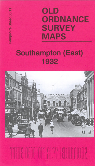
 Here are the details of maps for Southampton & Itchen:
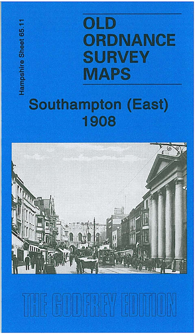

We have published two versions of this map, showing how the area changed across the years.
The maps cover much of the city centre of Southampton, continuing acropss the River Itchen to part of Itchen parish. Coverage stretches from the High Street eastward to Manor Road Itchen, and from Clovelly Road southward to Canute Road.
The many features include Bargate, Hartley University College, St Mary's church, Holy Rood church, All Saints church, Deanery, Cattle Market, Hoglands, Houndwell, East Park, Kingsland Square, Town & Dock station, Northam station, Itchen Ferry, Coal Barge Dock, Chapel, Crosshouse, Belvidere, many wharves along the Itchen, tramways, Millbank, St Augustine's church, Nichols Town, Millstone Point. East of the Itchen features include Peartree, Oakbank Ballast Wharf, Hill Street, area where Supermarine Aviation Works would be established, Woolston station and northern part of Woolston, Jesus Church. On the reverse we include street directories for Canute Road, High Street, Marine Parade, Marsh Lane, Queen's Terrace, South Front.
The map links up with Hampshire Sheets 65.10 Southampton West to the west and 65.15 Southampton Docks to the south.