Old Ordnance Survey Maps of Southampton (W)


We have published more than 2,000 maps in our series of Old Ordnance Survey Map reprints, including a good groups in Hampshire. The maps are highly detailed. They are taken from the OS 1:2,500 (or 25 inch) maps and reduced to about 15 inches to the mile. Each covers an area of a mile and a half by a mile. They show streets with individual houses, tram tracks, railway tracks and even signals, factories, wharves and such details as fountains and water troughs. They will provide hours of fascination for historians and genealogists. The maps are neatly folded and each includes a specially written introduction to the area. Maps can be purchased on our On-line Mapshop where further information about titles is given. Or visit The Index Page for a full list to the series and details of Prices.


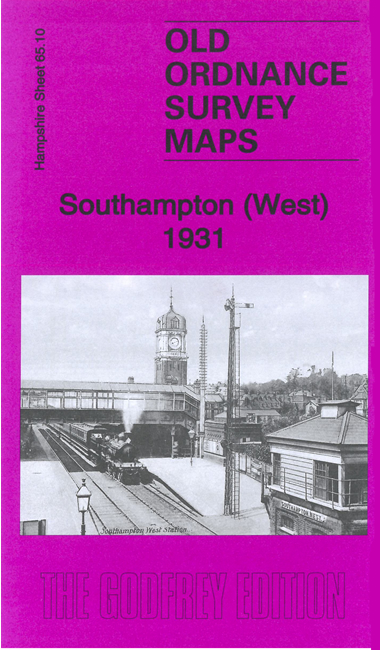
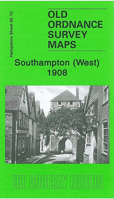
  • Here are the details of maps for Southampton (West):

  • Hampshire Sheet 65.10 Southampton (West) 1908 - published 2007; introduction by Alan Godfrey.

    Few areas have changed more comprehensively than this highly detailed map, for in 1908 the tide still came up to the western shore, and almost up to the station. This land was infilled as part of the Western Docks project between 1927 and 1934. Our map shows the area from French Street northward to Polygon Road, and westward to Waterloo Road. Though much of the map was therefore mud and sand in 1908 - with several creeks, there is still much of interest, features including Bugle Street, St Michael's church, Western Esplanade, Corporation Baths, West Quay, Lansdowne Hill, Polygon, West Marlands (before the Civic Centre was built), West Park, Thorners Charity, Southampton West station, Fourposts, Blechynden.

    The map links up with Hampshire Sheet 65.11 Southampton East to the east.


    Follow this link for a complete list of our Hampshire Series maps.

    You can order maps direct from our On-line Mapshop. For other information and prices, and other areas, go to The Index Page.


    Maps in the Godfrey Edition are taken from the 25 inch to the mile map and reduced to about 15 inches to the mile. For a full list of maps for the South West, return to the South West page.

    The Godfrey Edition / sales@alangodfreymaps.co.uk / 20 November 2007