
 Here are the details of maps for Wotton under Edge:

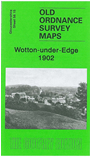
This detailed map is double sided to provide maximum coverage of this small south Cotswolds town. The main map covers the western part of the town, with coverage extending from Church Street westward to New Mills (shown here as working Elastic & Pins) and Berryhill Farm, and southward to Langford silk mill and Hawpark Farm. Features include Merlin Haven, Bradley, Wotton Hill, Bushford Bridge, The Butts, Long Street, Hack corn mill, Chipping House, Ellerncroft. On the reverse we include a good section of adjacent sheet 56.16, covering St Mary's church, Potters Pound, Ragnall, Holywell, Coombe House, Sinwell, Silverstreet, Dyersbrook, and extending east to Warren Wood and Torhill Quarries.
Maps in the Godfrey Edition are taken from the 25 inch to the mile map and reduced to about 15 inches to the mile. For a full list of maps for England, return to the England page.
Alan Godfrey Maps, Prospect Business Park, Leadgate, Consett, Co Durham, DH8 7PW / sales@alangodfreymaps.co.uk / 28 October 2016